
Photograph, black-and-white.
Strait Area Museum
Tous droits réservés.
| Nom de l'objet : | Photograph, black-and-white. |
|---|---|
| Catégorie de l'objet : | Graphic Documents |
| Matériaux : | Photographic paper. |
| Numéro d'accession : | p2023.29 |
| Date de début de production : | 1951-01-01 |
| Date de fin de production : | 1951-12-31 |
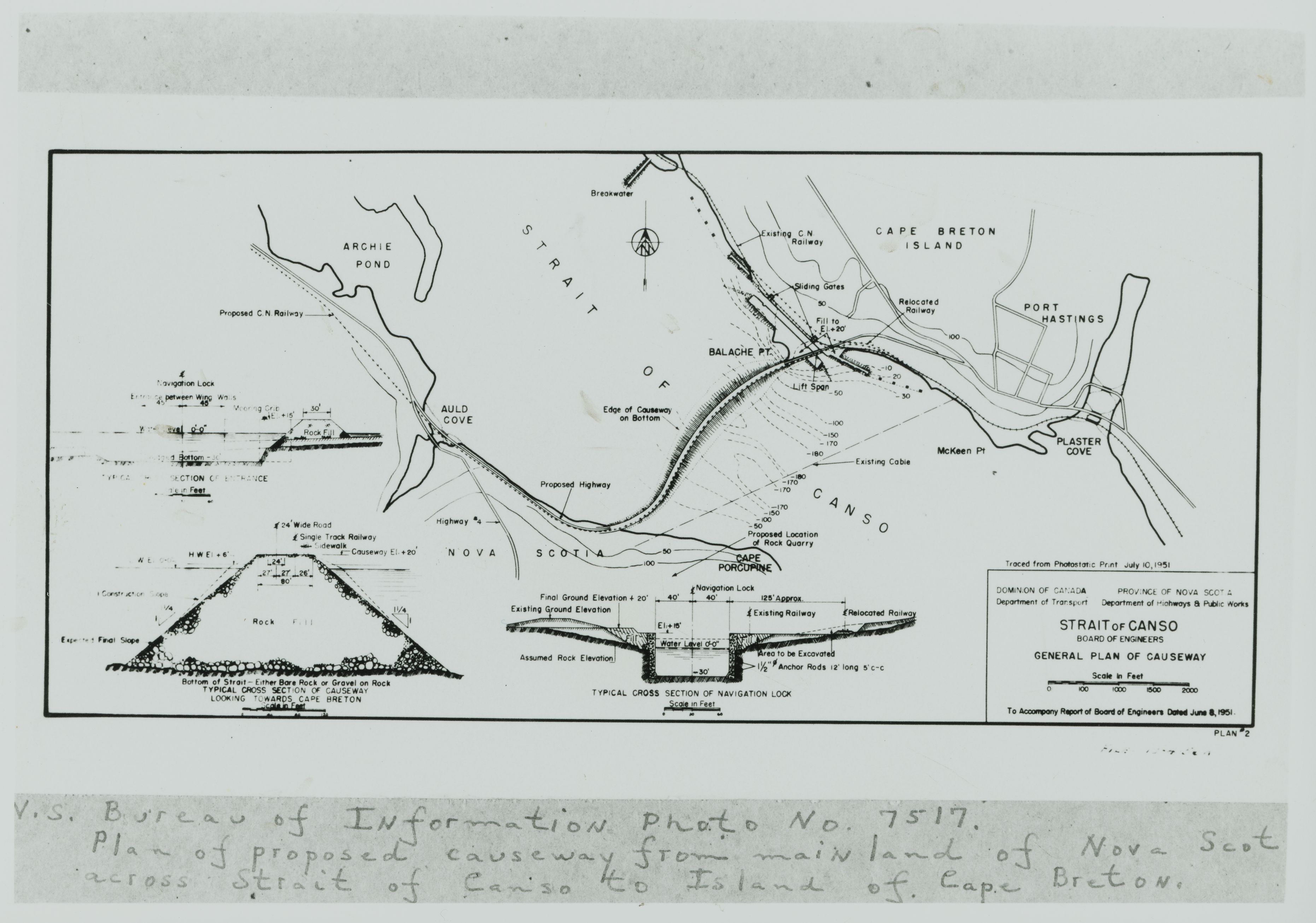
| Description : | This photograph shows a picture of the general plan of the Canso Causeway. The legend in the bottom right side of the photograph says "Traced from Photostatic print July 10, 1951. Dominion of Canada Department of Transport. Province of Nova Scotia Department of Highways and Public Works. Strait of Canso Board of Engineers General Plan of Causeway. To Accompany Report of Board of Engineers Dated June 8, 1951." The description at the bottom of the photograph says "V.S Bureau of Information Photo No. 7517. Plan of proposed causeway from the mainland of Nova Scotia across the Strait of Canso to Island of Cape Breton." To the bottom left of the photograph, there is a sketch of a rock pile and a description that says "Bottom of Strait-either Bore rock or gravel on rock. Typical cross-section of Causeway looking towards Cape Breton." To the left of the legend, there is a sketch of the locks. The description under the sketch says " Typical Cross Section of Navigation Lock." Above this is the sketch of the Strait of Canso, the planned Causeway, the proposed C.N Railway, Auld's Cove, and Port Hastings. |
| Longueur : | 12cm |
| Largeur : | 16cm |
| Établissement : |
Strait Area Museum
 Facebook-Strait Area Museum Facebook-Strait Area Museum
|
| Ville de l'établissement : | Port Hastings |
| Province de l'établissement : | Nova Scotia |