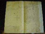
chart, navigational
| Nom de l'objet : | chart, navigational |
| Artiste ou artisan : | capitain H.W. Bayfield |
| Catégorie de l'objet : | Communication Artifact |
| Sous-catégorie de l'objet : | Documentary Artifact |
| Matériaux : | canvas, paper |
| Numéro d'accession : | 2004-341 |
| Date de fin de production : | 19th century (?) |
| Description : | A paper navigational chart; stuck to canvas and hand-made. It indicates tide lines and sand bank (in red), harbors and depths, revers and other physical features. The right side of the chart is uneven, approx. 5 cm are missing. The title of the document is "Bradore bay and harbour- surveyed by captn H.W. Bayfield R.N. F.A.S.-Enlarged and designed by". On the reverse side, in black ink, the following is written: " Vault-map of Bradore bay harbour by capt Bayfield". |
| Largeur : | 55,6 |
| Unité de mesure linéaire : | cm |
| Nombre de parties composantes : | 1 |
| Établissement : |
Morrin Centre
 Facebook-Morrin Centre Facebook-Morrin Centre
 Twitter-Morrin Centre Twitter-Morrin Centre
 YouTube-Morrin Centre YouTube-Morrin Centre
|
| Ville de l'établissement : | Québec |
| Province de l'établissement : | Quebec |
Coordonnées de cette page web
-
Pour proposer des corrections ou des mises à jour sur cette page, veuillez contacter directement le Réseau canadien d’information sur le patrimoine (RCIP).
